
Know before
you fly.
The weather app built for drone pilots. SkyCheck checks every hour of the forecast against your drone's limits: wind at the height you fly, gusts, rain, airspace and lightning. Then it gives you a straight answer.
- Free to download
- iPhone and iPad
- Lightning & TFR alerts free for everyone
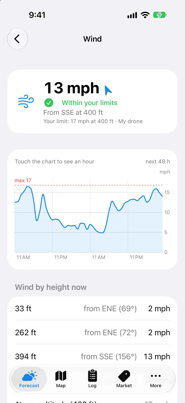
Wind at the height you fly
Calm on the ground isn't calm at 400 ft.
Most weather apps tell you the wind at 33 feet. Your drone is ten times higher. SkyCheck shows wind and gusts at your flight altitude, the number that decides whether your drone makes it home.
Real forecast from one afternoon in SkyCheck.
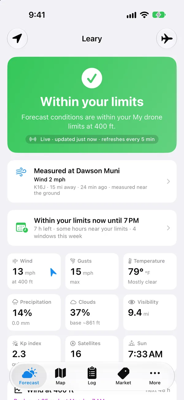
Limits for your drone
One clear answer instead of twenty tabs.
Pick your drone and SkyCheck loads its real wind, temperature and GPS limits. Every hour of the forecast gets checked against them, with the reason spelled out.
Everything before takeoff
Your whole preflight,
in one app.
Weather, airspace, radar and alerts in the same place, all built around the drone you fly.
Wind & gusts at altitude
Up to 400 ft, hour by hour, plus live wind measured at the nearest airport.
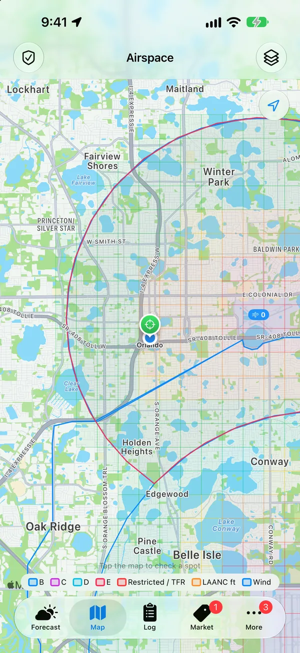
Airspace, TFRs & LAANC grid
Class B, C, D and E, restricted areas, temporary flight restrictions and the ceiling for every LAANC grid square.
Lightning alerts
Satellite lightning data checked about every minute. You get a push when strikes get close, and another when it's clear.
TFR alerts
Stadium game, VIP visit, wildfire. Know when a new flight restriction appears near your spots.
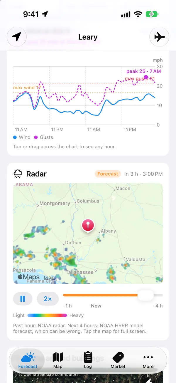
Live radar
The last hour of radar, plus a forecast of where the rain is headed next.
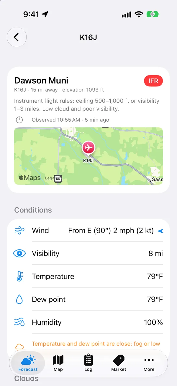
Airport weather, decoded
The nearest METAR and TAF in plain English: flight category, wind, visibility and ceiling.
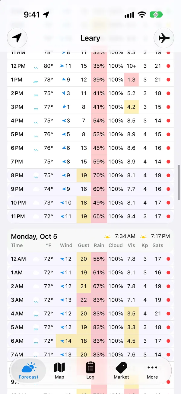
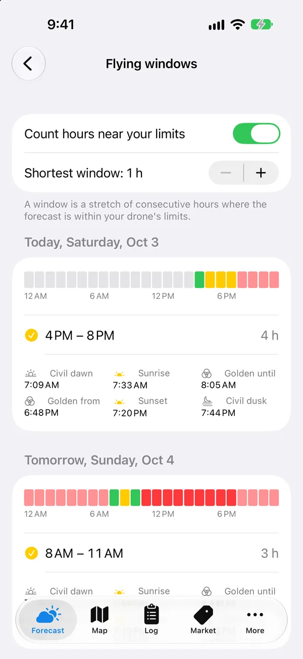
Flying windows
The stretches of each day that are within your limits, seven days out, with sunrise, sunset and golden hour.
GPS satellites & Kp index
How many satellites are overhead and whether a solar storm could throw off your GPS and compass.
Widgets, Siri & flight log
Your verdict on the Home and Lock Screen, "Hey Siri, can I fly now?", and a log that saves the weather of every flight.
Take a look
Designed to read in a glance.
Built the way iPhone apps should be: fast, clean and easy to read in bright sun at the field.
Alerts that matter
It watches the sky so you don't have to.
SkyCheck keeps checking even when the app is closed. Lightning and new flight restrictions are free for every pilot, because safety shouldn't be a subscription.
30 seconds
See SkyCheck in action.
Read the video transcript
Narrator and on-screen text for the 30-second SkyCheck video. Music plays under the voice; there are no other sounds.
- On screen: “Should you fly today?” Narrator: “Should you fly today?”
- On screen: an iPhone shows SkyCheck’s forecast with a green “Within your limits” verdict, then the wind screen. Captions: “Go or no-go, at a glance” and “Wind where you fly, at 400 ft, not just on the ground.” Narrator: “SkyCheck checks the weather against your drone’s limits, at the altitude you fly.”
- On screen: the hour-by-hour table and the flying-windows calendar. Captions: “Every hour, seven days out” and “Your next flying window.” Narrator: “Every hour, seven days out, with your next flying window.”
- On screen: the airspace map with LAANC grids, then live radar. Captions: “Airspace you can read” and “Radar, now and next.” Narrator: “Airspace, TFRs, and LAANC grids, plus live radar.”
- On screen: an alert notification, then decoded airport weather. Captions: “Alerts that find you” and “Airport weather, decoded.” Narrator: “Alerts that find you, and real airport weather.”
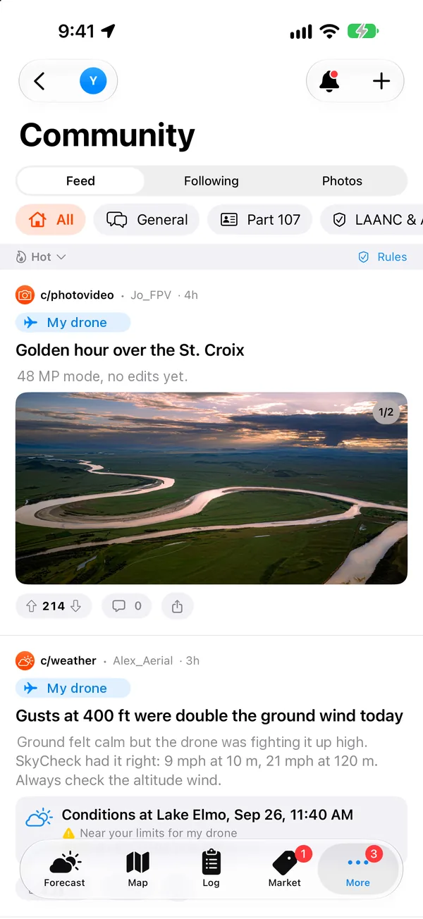
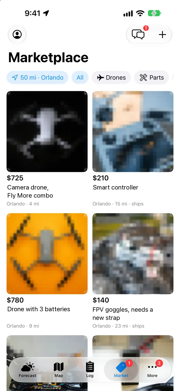
- On screen: the pilot community feed, then a local marketplace listing with the seller’s flight history. Captions: “Pilots near you” and “Buy and sell gear locally.” Narrator: “Meet pilots near you, and buy and sell gear locally.”
- On screen: the SkyCheck app icon and logo, “Know before you fly.” “Free on the App Store.” “Try Pro free for one week.” Narrator: “SkyCheck. Know before you fly. Free on the App Store.”
Pricing
Free to fly with.
Pro when you're serious.
The essentials are free for everyone. Pro adds the full week, the airspace map and alerts that run in the background.
Free
For every pilot, no trial clock.
- Today's hour-by-hour forecast and verdict
- Limits for your drone
- Wind and gusts at your altitude
- Live radar and decoded airport weather
- Lightning and TFR alerts
- Sunset and civil twilight reminders
- Pilot community, plus buying on the marketplace
SkyCheck Pro
or $99.99 a year · 1-week free trial
- Everything in Free, plus:
- Every hour for the next 7 days, with wind charts
- Flying windows and flying-window alerts
- Airspace map, TFRs and the LAANC grid
- Live weather alerts for your spots
- Flight log with the weather saved
- Several drones, each with its own limits
- Widgets, Siri, and selling on the marketplace
Prices in USD. Payment is charged to your Apple Account. Subscriptions renew automatically unless canceled at least 24 hours before the end of the period; manage them in your Apple Account settings. Terms of Use · Privacy Policy
FAQ
Questions pilots ask.
Is SkyCheck free?
Yes. SkyCheck is free to download, and the free version gives you today's forecast checked against your drone, wind at your altitude, radar, airport weather, lightning and TFR alerts, and the community. Pro is $9.99 a month or $99.99 a year, with a 1-week free trial.
Does SkyCheck tell me I'm allowed to fly?
No. SkyCheck is a planning tool. It shows weather and airspace so you can make a better decision, but it isn't an official weather briefing or an FAA authorization. Get LAANC or DroneZone approval where it's required, check the real conditions, and remember you're the pilot in command.
Which drones does it work with?
Any drone. Pick yours from the built-in catalog of popular models and SkyCheck sets its wind, temperature and GPS limits from the published specs. Flying FPV, a home-built or something not on the list? Set your own limits.
Why is wind at altitude different from my weather app?
Regular weather apps report wind about 33 ft above the ground. Wind usually gets stronger with height, so at 300–400 ft it can be several times faster. SkyCheck shows the forecast at the altitude you actually fly.
Where does the data come from?
Forecasts from Open-Meteo, airport observations, radar, lightning and space weather from NOAA, satellite orbits from CelesTrak, and airspace and TFRs from the FAA. See all data sources.
What devices does it run on?
iPhone and iPad. Widgets work on the Home Screen and Lock Screen, and Siri can answer "Can I fly now?"
Where does SkyCheck work?
SkyCheck is built for pilots in the United States. Airspace, TFRs, LAANC, lightning and radar cover the U.S. (radar covers the lower 48 states).
Who makes SkyCheck?
SkyCheck is made by GK Enterprise LLC. Questions or ideas? Email support@skycheck.app. We read everything.
Fly smarter, starting
with your next flight.
Free on iPhone and iPad. Launching soon. Follow along so you're first to know.Try Pro free for a week.